
ThreatForward: Pilot Flight Path Verification & Airfield Threat Intelligence
An air-gapped, mission-critical iOS application built for commercial and charter aviators. Enables pilots to download the last 5 verified approach paths per airport before boarding, providing offline mathematical certainty to cross-verify Air Traffic Control ground station coordinates before landing in remote international airspaces.
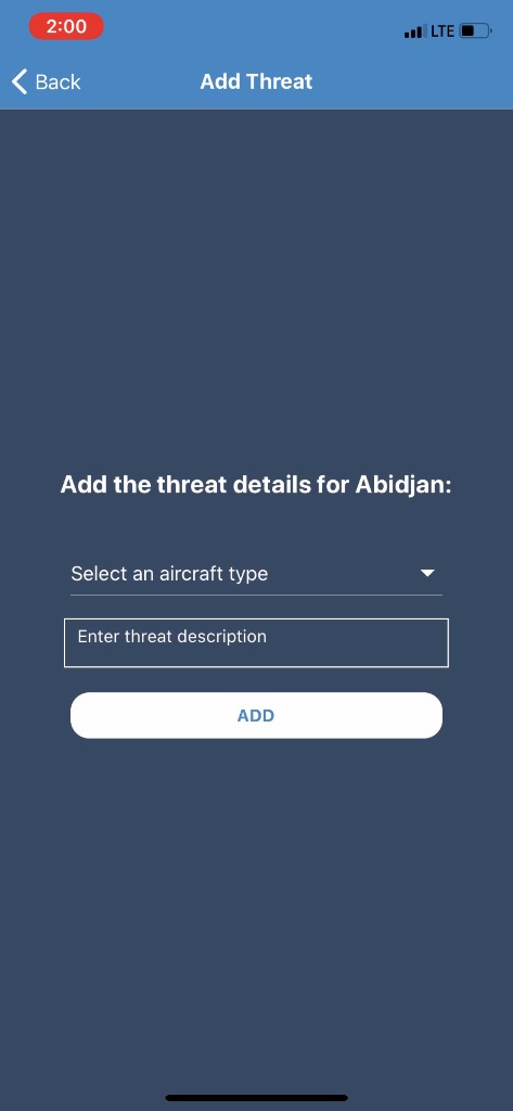
Radar Calibration Drift, Unverified Ground Stations & Zero In-Cockpit Wi-Fi
When commercial aircrews and charter pilots operate into developing or remote aerodromes — such as Felix-Houphouët-Boigny International in Abidjan, Côte d'Ivoire, and remote air corridors in Africa and the Middle East — they encounter a dangerous operational friction point.
Ground Station Lat/Long Calibration Drift
Local Air Traffic Control (ATC) radar sensors and VHF beacon coordinates occasionally suffer maintenance discrepancies or delayed WGS84 datum recalibrations. Pilots descending at 250 knots need absolute independent verification that coordinates transmitted by tower controllers match genuine historical approach paths.
Zero Cockpit Cellular or Satellite Reliance
During descent between Flight Level 350 and runway touchdown, aircraft cockpit cabins have zero cellular connectivity and cannot depend on satellite links during storm cells or line-of-sight dropouts. The application had to operate 100% air-gapped with zero external API calls in flight.
Airframe-Specific Threat Disparities
Hazards reported near an approach corridor — laser illumination, wind shear, glideslope shadow, or obstacle clearances — affect a heavy Boeing 777-300ER drastically differently than an ATR-72 turboprop. Threats had to be filtered and tagged strictly by specific airframe category.
Air-Gapped Telematics, Pre-Boarding Sync & Spherical Trigonometry
ONS Tech Global designed and implemented a dual-stage architecture: a high-throughput server ingest engine that continuously curates commercial flight paths, paired with an air-gapped native iOS Electronic Flight Bag (EFB) client.
Pre-Boarding 5-Track Download Pipeline
While the flight crew is in the dispatch lounge or hotel Wi-Fi prior to boarding, they select their scheduled destination airfield (e.g. ABJ / DIAP - Abidjan). The iOS client queries the encrypted ONS Tech backend and downloads the last 5 validated commercial approach vectors, caching waypoints, altitudes, and beacon lat/long coordinates into a zero-latency on-device SQLite database.
On-Device Geodesic Coordinate Cross-Check
Prior to landing approach, the pilot inputs the ATC ground station’s designated final fix coordinates. With zero cellular connection, the iOS engine performs spherical trigonometry (Haversine & Vincenty geodesic formulas) comparing the ground station coordinates against the 5 cached historical trajectories. Any variance exceeding FAA/ICAO tolerance thresholds triggers an instant visual alert.
Airframe-Class Threat Intelligence Repository
Pilots can catalog real-time airfield threats — unauthorized laser activity, microburst zones, glide-path anomalies, or taxiway construction — filtered specifically by aircraft class: Wide-body (A350/B777), Narrow-body (A320/B737), or Turboprop/Regional. Upon landing, threat dossiers queue for opportunistic background sync once cellular data reconnects.
Dark-Cockpit Human Factors & EFB Ergonomics
Designed strictly according to FAA Advisory Circular AC 120-76D guidelines for Electronic Flight Bags. The interface employs a specialized muted blue-gray and amber palette that eliminates cockpit glare, prevents night vision desensitization, and provides large tap targets operable during severe turbulence.
Full-Stack Aviation Technology Stack
- • Swift 5.9 • SwiftUI
- • CoreLocation Geofencing
- • CoreAnimation GPU Engine
- • Custom EFB Dark Shader
- • SQLCipher AES-256
- • Spatial R-Tree Indexing
- • Ring-buffer 5 Flight Paths
- • 0.08s Cold Query Time
- • ADS-B Ingestion Workers
- • Redis Trajectory Cache
- • RESTful JSON-LD Endpoints
- • Sub-150ms Sync Payloads
- • WGS84 Geodesic Math
- • Air-Gapped Cockpit Mode
- • Zero In-Flight Data Leaks
- • Airframe-Specific RBAC
Quantifiable Aviation Safety & Cockpit Confidence
ThreatForward transformed approach preparation for flight crews flying into non-standard international aerodromes.
Zero reliance on satellite links or cellular connectivity during final approach, completely immune to airborne radio dead zones.
Instant on-device comparison of ATC ground station coordinates against 5 historical approaches, giving pilots immediate confirmation.
Muted dark-cockpit design preserving pilot night vision throughout critical descent, approach, and landing phases.
See ToursGrenada: Cruise Tour & Excursion Ecosystem
Have a Mission-Critical Mobile or Telematics Project?
Speak directly with our senior software architects. We build resilient, offline-first mobile applications, real-time IoT platforms, and secure enterprise software architectures.